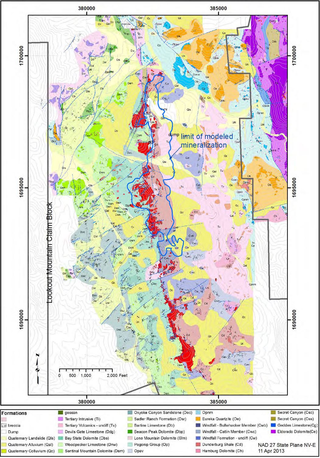
At Lookout Mountain, drill-indicated Carlin-style gold mineralization occurs along a 5 km north-south trending structural zone separating Devonian rocks to the west, from Cambrian rocks to the east. The structural zone is extensively silicified to form jasperoid which is typically brecciated. Northeast- and northwest-directed cross structures play an important part in localizing gold mineralization which occurs along the silicified structural zones and as replacement of favorable carbonate and shale strata. The rocks are variably fractured and typically oxidized, but with localized high-grade sulfidic mineralization.
Geologic Map of the Lookout Mountain Resource Area
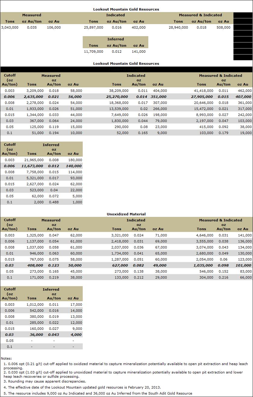
Gold Resource
Approximately 690 holes have been drilled at Lookout Mountain since the 1960’s with approximately 175 by Timberline since 2012. These holes have been the basis for definition of a NI43-101 gold resource by Mine Development Associates in 2012 and 2013.
Lookout Mountain NI43-101 Gold Resource by MDA (2013)
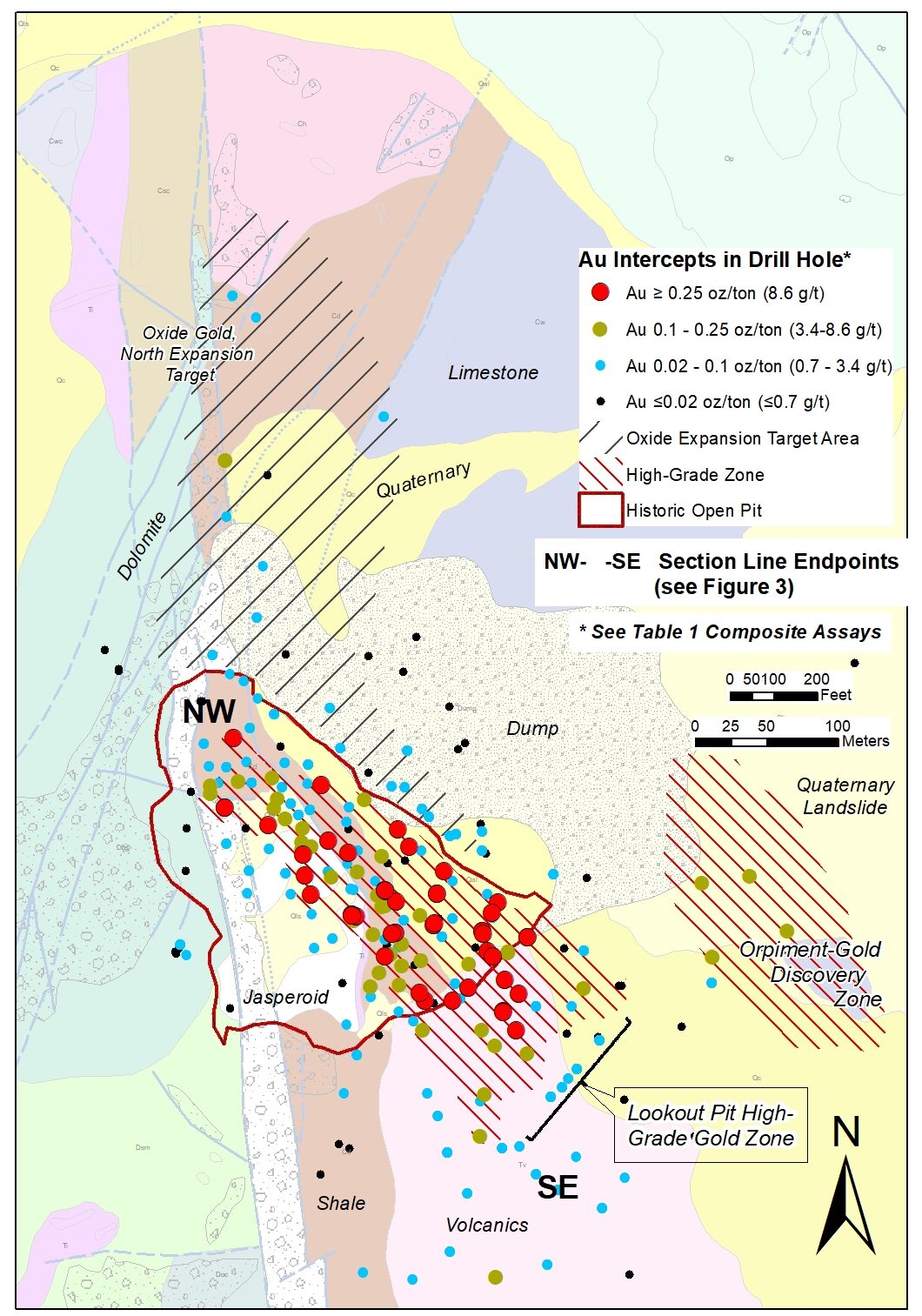
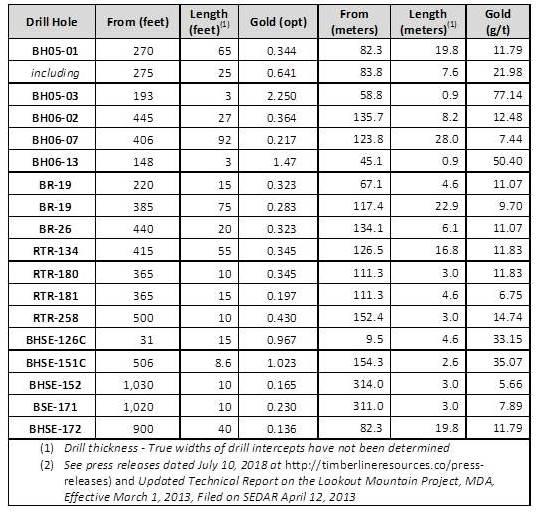
Lookout Mountain Drill Core with High-grade (>0.10 oz/ton) Gold with Collapse-breccia and Arsenic Sulfide Pathfinder Mineralization
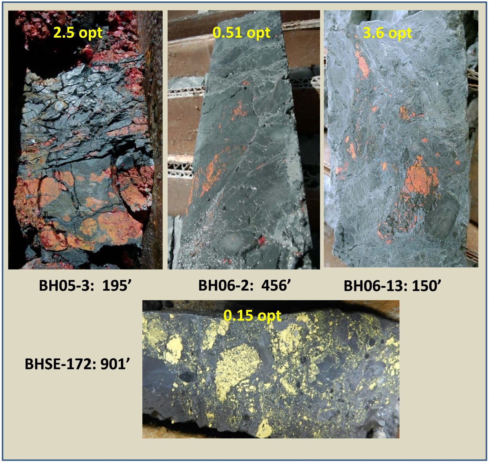
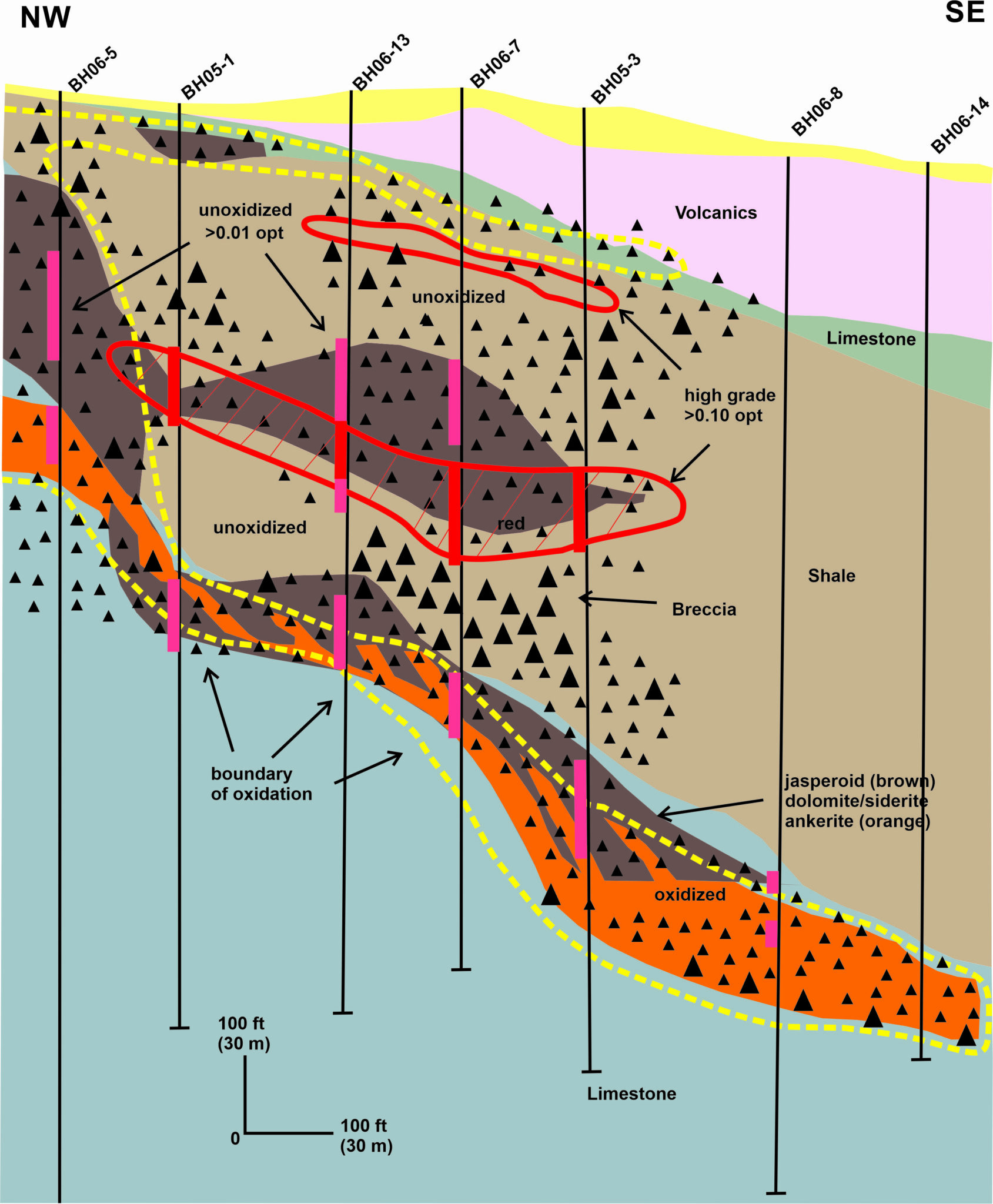
The drill holes with higher-grade intercepts tend to cluster along a southeast-trend below and adjacent the historic Lookout Mountain open pit. The high grade gold (up to multi-oz) forms a zone flanking a district prominent magnetic anomaly, and the low-grade mineralization of the NI43-101 resource. The gold appears to be associated with flat-lying multi-staged collapse breccias, carbonate dissolution, and iron addition. Gold was introduced with brassy and sooty sulfides and As, Sb, Hg, Th, and Zn pathfinder elements.
Lookout Mountain Cross-section with Higher-grade (>0.1 oz/ton) Gold Intercepts
Geophysics
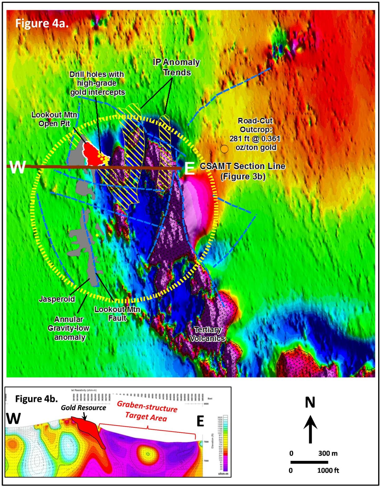
The zone of high-grade drill intercepts at Lookout Mountain appears to be coincident with an IP (chargeability) anomaly which cuts through the historic pit area. Similar IP anomalies occur further east of the pit as north-south trending zones, only one of which has been drilled (in one location) where similar high-grade drill intercepts were identified as in the pit area.
A follow-up gravity survey completed in 2018 shows an overall annular-shaped density low near the Lookout Mountain pit area which likely reflects silicification. The gravity, along with detailed magnetic images suggest there are multiple structures in the area. A historic CSAMT survey provides excellent definition to the structural setting at Lookout Mountain where a resistivity low delineates an approximately 900 m fault bounded, graben-like basin. The western fault-bounded margin of the graben-shaped basin appears to be a primary control on the Lookout Mountain resource mineralization. The eastern 1/2 to 2/3 of the basin, including the east marginal fault zone is essentially undrilled to-date.
Lookout Mountain area RTP Magnetics with Summary IP Anomaly Trends, and CSAMT cross-section with Target Area.
Exploration at Lookout Mountain is completed under an existing Plan of Operation (PoO) approved by the Bureau of Land Management (BLM). Expansion of drilling on high grade gold targets has been approved as an update of the PoO along with supplemental bonding.